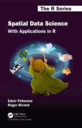
 Название: Spatial Data Science: With Applications in R
Автор: Edzer Pebesma, Roger Bivand
Издательство: CRC Press
Серия: The R Series
Год: 2023
Страниц: 315
Язык: английский
Формат: pdf (true)
Размер: 29.5 MB
Spatial Data Science introduces fundamental aspects of spatial data that every data scientist should know before they start working with spatial data. These aspects include how geometries are represented, coordinate reference systems (projections, datums), the fact that the Earth is round and its consequences for analysis, and how attributes of geometries can relate to geometries. In the second part of the book, these concepts are illustrated with data science examples using the R language. In the third part, statistical modelling approaches are demonstrated using real world data examples. After reading this book, the reader will be well equipped to avoid a number of major spatial data analysis errors.
The book gives a detailed explanation of the core spatial software packages for R: sf for simple feature access, and stars for raster and vector data cubes – array data with spatial and temporal dimensions. It also shows how geometrical operations change when going from a flat space to the surface of a sphere, which is what sf and stars use when coordinates are not projected (degrees longitude/latitude). Separate chapters detail a variety of plotting approaches for spatial maps using R, and different ways of handling very large vector or raster (imagery) datasets, locally, in databases, or in the cloud. The data used and all code examples are freely available online. The solutions to the exercises can be found at the site.
Data Science is concerned with finding answers to questions on the basis of available data, and communicating that effort. Besides showing the results, this communication involves sharing the data used, but also exposing the path that led to the answers in a comprehensive and reproducible way. It also acknowledges the fact that available data may not be sufficient to answer questions, and that any answers are conditional on the data collection or sampling protocols employed.
This book introduces and explains the concepts underlying spatial dаta: points, lines, polygons, rasters, coverages, geometry attributes, data cubes, reference systems, as well as higher-level concepts including how attributes relate to geometries and how this affects analysis. The relationship of attributes to geometries is known as support, and changing support also changes the characteristics of attributes. Some data generation processes are continuous in space, and may be observed everywhere. Others are discrete, observed in tesselated containers. In modern spatial data analysis, tesellated methods are often used for all data, extending across the legacy partition into point process, geostatistical and lattice models. It is support (and the understanding of support) that underlies the importance of spatial representation. The book aims at data scientists who want to get a grip on using spatial data in their analysis. To exemplify how to do things, it uses R. In future editions we hope to extend this with examples using Python and Julia.
Скачать Spatial Data Science: With Applications in R