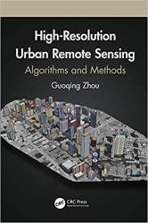
 Название: Urban High-Resolution Remote Sensing: Algorithms and Modeling
Автор: Guoqing Zhou
Издательство: CRC Press
Год: 2021
Страниц: 368
Язык: английский
Формат: pdf (true)
Размер: 15.8 MB
With urbanization as a global phenomenon, there is a need for data and information about these terrains. Urban remote sensing techniques provide critical physical input and intelligence for preparing base maps, formulating planning proposals, and monitoring implementations. Likewise these methodologies help with understanding the biophysical properties, patterns, and process of urban landscapes, as well as mapping and monitoring urban land cover and spatial extent.
Advanced sensor technologies and image processing methodologies such as deep learning, data mining, etc., facilitate the wide applications of remote sensing technology in urban areas. This book presents advanced image processing methods and algorithms focused on three very important roots of urban remote sensing: 3D urban modelling using different remotely sensed data, urban orthophotomap generation, and urban feature extraction, which are also today’s real challenges in high resolution remote sensing. Data generated by remote sensing, with its repetitive and synoptic viewing and multispectral capabilities, constitutes a powerful tool for mapping and monitoring emerging changes in the city's urban core, as well as in peripheral areas.
Very high resolution (VHR) remotely sensed (RS) images are widely available because of the fast development of advanced remote sensing technology. As the VHR RS images contain abundant ground information at pixel-level, they have therefore attracted end users’ attention to their application in urban mapping, precision agriculture, forest monitoring, and so on. However, the traditional RS image classification methods depending only on spectral information have been demonstrated to be inadequate. On the one hand, the VHR RS image classification suffers from uncertainty of spectral information due to the low intra-class variance and the high inter-class variance, which causes a decrease in the separability of different kinds of objects in the spectral domain, particularly for the spectrally similar classes. How to effectively implement VHR RS image classification has become a research focus. On the other hand, spatial correlation is more important and spatial properties should be considered for the VHR images processing.
Deep neural networks (DNNs) trained in an end-to-end manner have been found to be more powerful in high-level features extraction than the existing feature extractors depending on carefully engineered representations, such as the histogram of oriented gradient (HOG), morphological profiles, and scale-invariant feature transform (SIFT) features. This is because of the invariance properties of DNNs to the transformation of local imagery. Convolutional neural networks (CNNs) are effective DNNs, given that they can be adjusted by setting adaptive breadth and depth. Moreover, CNNs have fewer parameters and connections compared to other DNNs.
Features:
Provides advances in emerging methods and algorithms in image processing and technology
Uses algorithms and methodologies for handling high-resolution imagery from a ground sampling distance (GSD) less than 1.0 meter
Focuses on 3D urban modelling, orthorectification methodologies, and urban feature extraction algorithms from high-resolution remotely sensed imagery
Demonstrates how to apply up-to-date techniques to the problems identified and how to analyze research results
Presents methods and algorithms for monitoring, analyzing, and modeling urban growth, urban planning, and socio-economic developments
In this book, readers are provided with valuable research studies and applications-oriented chapters in areas such as urban trees, soil moisture mapping, city transportation, urban remote sensing Big Data, etc.
Скачать Urban High-Resolution Remote Sensing: Algorithms and Modeling